Wednesday, June 24, 2009

VICK and SHIL

Corinth, MS

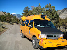
Haven't posted at all this trip yet... apologies... it's just too damn hot to get motivated. I guess they broke a record in Vicksburg yesterday at 100. The van doesn't have the best air conditioning to begin with, so when you turn on 7 computers and fire up some strobe lights, it's pretty much like an oven with air blowing on you. I think our thermostat said anywhere between 91 and 96 inside the van.

Started in New Orleans on Monday. Hot. Had to do some work on the truck, stayed on the outskirts.

Drove up to Vicksburg on Tuesday.


View Larger Map

Collected all of the park, like I mentioned hot. Sticky hot... reminded me of why I like Colorado heat so much. It's hot, but it doesn't make your clothes a continuation of your skin for the rest of the day.

Vicksburg National Military Park was pretty neat. They have an ironclad on display there... inspiration for the ever-typical McConaughey movie (Sahara)...

The museum next to it didn't open until 930 this morning though, so we didn't get a chance to look at it. Pretty neat looking thing though, I think they fished it out of the Yazoo River after it sank.... I don't think McConaughey helped.

The battle of Vicksburg, like Chattanooga, is associated with the rise of Grant through the ranks of the US Army. He was part of the command that laid siege to Vicksburg for over a month. The siege ended on July 4th, 1863... a day after Gettysburg. Also since it ended on the 4th of July, the city of Vicksburg didn't celebrate it again until 1931, a little salty I guess.

Lincoln famously said that "Vicksburg is the key...." meaning that since Vicksburg is an important port/passage on the Mississippi it must be held in Union control to ensure victory.

Ate dinner at a nice place in town last night. Rusty's Riverfront Grill... I think it was burned down and rebuilt since that picture. I ate some alligator though and as you might expect... pretty much like a fishy tasting chicken. Also had some soft-shell crab stuff with Maryland crab... not too shabby.


Today we drove up to Corinth (I guess it's pronounced "Caar-inth", imagine it with a southern twang). Also the site of another important Civil War battle.

View Larger Map

The drive up consisted of driving on Natchez Trace Parkway, NPS owned. It traces the path that many Native Americans took when moving between the Southern Mississippi valley and Tennessee. It was nice, had a lot of trees coming over the road, very picturesque. Although I once had this question on trivial pursuit...

"What NPS Parkway has sometimes been called the boringest road in America?"

You guessed the answer... Natchez Trace... I guess I would have to disagree... I've been on much more boring... maybe I-80 through Wyoming? Nebraska? Iowa? Any of those would work.

More about Corinth... this town was put under siege after the bloody battle of Shiloh. The town is an important railroad crossing, so whomever had control would have crucial supply sources.

We're collecting the Shiloh battlefield tomorrow, it's about 30 miles NE of here. Then onto Memphis, then home to Denver on Friday. Nice short trip. Good thing, this heat is making me sick I think.

Friday, June 5, 2009

Gulf Islands and home...

Biloxi, MS

Finished up GUIS today; quite a spread out park. Had to drive to the Mississippi section of the park, about 2.5 hours from the Florida section. Here's a map of where the van went today...


View Larger Map

Nice long bridge on the way into Mobile, pretty neat. Flying out of New Orleans tomorrow at 3... never been there and wish I could spend a little more time; but I'm looking forward to getting back. We're gonna bum around New Orleans a bit before the flight, should be interesting.

Ate at a place called "The Shed" tonight.... really good BBQ. And it really is just a shed. Well worth the stop along I-10 though....thanks for the suggestion Mr. D.

Back home tomorrow, so probably no post... maybe I'll throw a post up sometime in the next couple of weeks with pics from New Orleans. Very productive this trip... 5 parks completed and about 17 parks to go until we're done with this collection cycle.

We're planning on heading back to the field on June 22nd. Couple of more Civil War Battlefields... Vicksburg and Shiloh.

Thursday, June 4, 2009

Gulf Islands

Navarre, FL
Had to include this pic... I scrambled to get this in time... just made it.

Well I thought it was gonna rain today... but we caught a break. Rained at like 6am, but with all the wind and the little tree cover it dried quickly. Nice change from all the foliage we've been dealing with.

Pretty interesting park here... actually caught another break because they just opened up one of their main roads to traffic again. They had to move the road north on the outer bank that it lies. The water table is so low out there that when it rains just a bit, the base of the road can get infiltrated. So they designed a better foundation and moved the road further from the gulf. I guess they just had the grand re-opening on the road on Tuesday and it was closed for 5 years... not too shabby.

Here's a map of the area that was just re-opened...


View Larger Map

As a result of all the new construction we also had do a little manual GPS collection (usually I just hit a button on the truck and magic... sub-meter GPS). We have other colleagues that prepare the parks for us before we arrive, assuring that all of the information the FHWA (Federal Highway Administration) has on file is accurate and up to date. However they couldn't get some of the parking areas since they weren't paved yet. We had to take out our GPS and take the information down.

This isn't your recreational GPS... costs a bit more as we demand a little higher accuracy and better transition into the data format we use. So I have a Trimble Ranger handheld along with a backpack that actually contains the GPS receiver and the antenna attached to the top of the backpack (2 ft above my head).

There's a lot of the beach in GUIS closed off because of the nesting of shorebirds. While I was collecting one of these new parking areas though... one of these shorebirds mistook my antenna for another bird because more than once I had to duck out of the way of their attack dives. There's a punchline here but I just can't think of a good one... anyone?

A buddy 0f mine asked for more pics of the van... I'll see what I can do... it's highly classified stuff in there... right...

Got to walk on the beach a bit too... here's a couple of pics... and one from my typical view.

The screen has important stuff on it... trust me...
Beach walk I took today...

Wednesday, June 3, 2009

Chattanooga to Gulf Islands, FL

Navarre, FL


View Larger Map

Got to drive the great state of Alabama today... really not that exciting. I think I liked West Virginia more. Gulf Islands National Seashore is the next and last park on the list for this productive trip. Should be pretty neat as it rests on the outer banks of the Florida panhandle.

The rain that's forecast for the next couple of days will not be nice. Part of my job is collecting pavement surface data on the roads in National Parks. We use cameras that record images of the pavement as we drive. Those images are then put into software to detect the cracking. When the road is wet however, cracks are either worse than reality or they are not detected at all. So I've learned to be a amateur meteorologist in this job as well.

Tomorrow it's probably off to the Naval Air Museum, heard it's supposed to be neat. It's nice to have days off on the road, but sucks that they only happen when it's raining out. No pics taken today, but hopefully tomorrow I can add some.

Tuesday, June 2, 2009

Chickamauga & Chattanooga

Chattanooga, TN

Started and finished Chick-Chat today... at least that's what the NPS folks call Chickamauga & Chattanooga National Military Park. I got to collect today and it was busy. Days like today are tough, I saw a lot of things from the car window that I'd like to get out and take a peak at; but time just did not allow. Rain is coming tomorrow and I really wanted to get this park done.

Chickamauga is a Civil War battlefield in Georgia just Southeast of Chattanooga. The Union forces just about got routed, but were able to retreat to Chattanooga. There they were put under siege by the Confederates until good 'ole Uncle Sam (Ulysses S. Grant) was able to break through with reinforcements.

If you've never been to a civil war battlefield (this was my 4th or so)... you'll see tons of monuments. They're erected for all the divisions of the military that served in the battle (e.g. 24th Minnesota regiment... etc.). They're all over though, some are simple and some are elaborate.

The other part of the park is Lookout Mountain. This is where the Union took the decisive batter and also where Grant made his last push before he became the General-in-chief of the Civil War. Chattanooga was an important railroad center for the South, so taking it was essential for the Union to cut the supply lines to Lee and the Army of Northern Virginia.

Here's a couple of pics I took on the top of Lookout Mountain.
"Point Park" at the top of Lookout Mountain.

"Moccasin Bend" in the Tennessee River.

Cannon over looking Chattanooga.

Tomorrow drive to Pensacola, FL and hopefully collect some of GUIS on Thursday... supposed to rain though.

Monday, June 1, 2009

Cumberland Gap

Chattanooga, TN


It's nice to get a lot of parks done on a trip, looks like we're gonna get 5 on this one. Already finished Mammoth Cave, Big South Fork, and Cumberland Gap National Historical Park today. Tomorrow it's Chickamauga & Chattanooga National Military Park. And then driving down to Gulf Islands National Seashore, by Pensalcola, FL on Wednesday.


View Larger Map

Cumberland was nice, good views and good history. It's a historical park for a couple of reasons, most of which being thousands of immigrants passed through this point in the late 18th and early 19th centuries. It's the only break (Gap) in the Appalachians for a hundred miles in either direction. It was the "Gateway to the West" back then, which is kinda tough to imagine today. "The West" conjures up a lot of different images for me and none of them contain Kentucky. But this was the West at one point. I can't imagine crossing it without air conditioning, it was hot as hell today. Here are some pics from the overlookView of the town Middlesboro, KY - West side of the Gap.


Another pic looking West.

Watched a movie in the visitor center which talked about how Cumberland Gap was of great strategic importance during the civil war. In face Grant called it the "Gibralter of America." No battle was fought there though.

Took a hike up to where Tennessee, Virginia, and Kentucky meet. Not quite the 4 corners, but pretty neat nonetheless. That's me standing in Kentucky and Virginia; Tennessee didn't make the cut.


Excited to collect a military park tomorrow, hopefully we get done early so we can check out the park a bit.
The truck...